Copyright: Tourist-Information Kelberg
Kelberger Wanderlust - Die Kelberger Panoramen
Type of tour:Hiking
-Difficulty:moderate
Duration3:19 h
Length14.1 km
Ascent208 hm
Descent209 hm
Elevation profile
Description
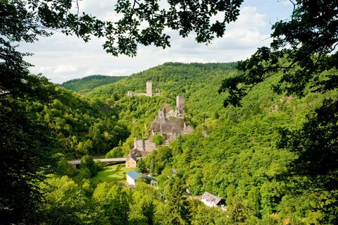
Gentle climbs offer sweeping views of the volcanic landscape of the Vulkaneifel, such as the Hochkelberg. Juniper heaths, fragrant meadows, and forest benches invite you to relax and linger.
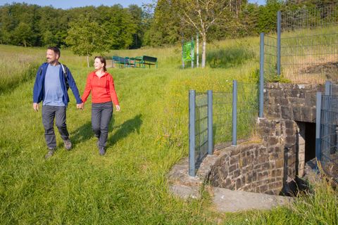
The hike starts at the Kelberg market square, where there is also a hiking parking lot. The route (track at the end of this report) first leads through the town and initially follows the same path as the Kelberg Episodes.
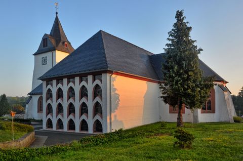
A notable landmark along the route through town is St. Vincent’s Parish Church, which stands like a fortress in the center of town.
The origins of the Kelberg parish date back to the 9th century. The parish church, believed to have been built between 1150 and 1200, combines architectural elements from various eras: The tower was likely built before 1200 in a massive architectural style, while the lower level is in the Romanesque style (Roman defensive tower).
Apart from the tower, hardly anything remains of the old parish church. The three bays of the nave were built in 1912–13 in the Neo-Gothic style. The choir, destroyed during World War II, was rebuilt after 1945. The modern transept was completed in 1972 and attempts to incorporate traditional forms. In 1996, the church underwent a comprehensive renovation.
The open “little chapel” in front of the church dates from 1708 and was renovated in 1950 (Small Church Guide of the Kelberg Parish). It’s well worth walking through the village with your eyes open and your senses alert. There are quite a few beautiful and lovingly restored historic buildings to see.
The trail leads to the outskirts of town, and it’s well worth walking through the village with your eyes open and your senses alert. There are quite a few beautiful and lovingly restored historic buildings to see.
At a rest area beyond the B257, the “Kelberg Episodes” and “Kelberg Panoramas” trails, which have run together until now, split. The hiking trail crosses the Trierbach, which rises on the Hochkelberg, and leads to the Mühlenberg. At the foot of the Mühlenberg stands a residential building that incorporates the structure of the Kelberg Mill. Together with a second mill, it gave the district of Zermüllen its name, which traces back to the reference “zur Molen” in a 1466 charter from the Daun office of the Electorate of Trier.
At the Mühlenberg, the panoramic views of Kelberg blend with the scenery of one of the increasingly rare juniper heaths. Idyllic meadow paths with lush vegetation lead us north around the Schwarzenberg, where a memorial cemetery and a pilgrimage chapel can be visited at the summit.
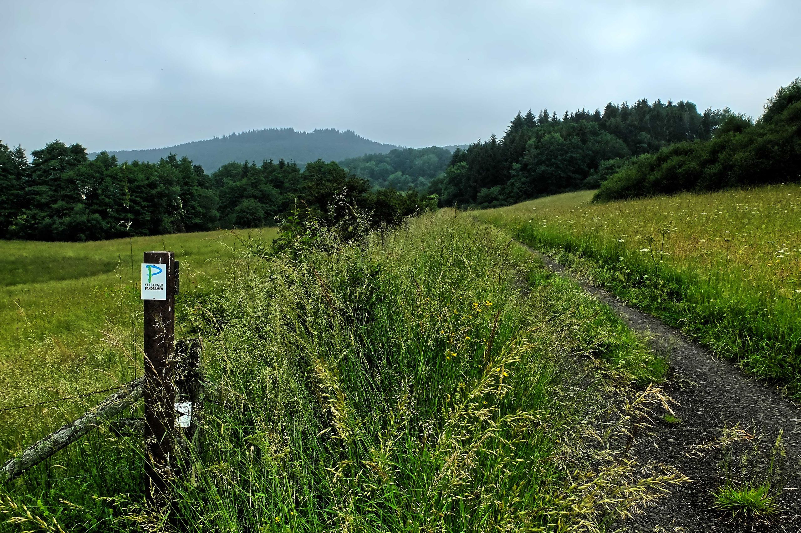
We had already seen the Schwarzenberg Chapel on the “Kelberg Episodes” hike. We continue on through sparse mixed forest and across a meadow landscape lush with tall grasses, structured by hedges and pasture fences. Cattle graze on the tall grass and pay us no mind as we step out into the open countryside again. The “Kelberger Panoramas” don’t offer highlights like the Stations of the Cross on the Schwarzenberg. However, it is a hiking trail in the best sense of the word, where the varied landscape of the Vulkaneifel captivates the eye time and again.
The trails are wide and easy to walk on despite the damp to wet weather. It’s a bit of a shame that the weather is preventing us from enjoying a truly good view into the distance. In the forest sections, however, the sunlight breaking through the clouds and treetops time and again gives us atmospheric, almost meditative moments that we thoroughly enjoy.
The hilly Vulkaneifel region frequently throws moderate climbs our way, where the trail narrows into narrower paths. It’s a nice change of pace, as we then walk on forest floor that’s easy on the joints. Every now and then, we make our way through overgrown brush, which is surely pushed back by all the hikers passing through over the course of the season.
Then the tree cover changes from deciduous to coniferous, and the spruce needles covering the trails make it feel like we’re walking on cotton: so soft and so silent that you can hear the stillness. The fluttering of forest birds and the rustling as small creatures scurry through the woods. Then the path widens, the trees recede, and we find ourselves once again on a plateau, crisscrossed by fences, hedges, and bushes.
These open areas always offer an unobstructed view of the Vulkaneifel surrounding the Hochkelberg. At 675 meters, the Hochkelberg is one of the ten highest mountains in the Vulkaneifel. It is a former stratovolcano, at the southern foot of which lies the Mosbrucher Weiher. Below its summit stands a transmission tower today. Originally, the mountain visible today lay 200 meters below the Earth’s surface. As the area was uplifted, the outer layers were eroded away, leaving the hard basalt core intact.
It will still take a little while before we reach the Hochkelberg and can begin the ascent, and the trail climbs steadily uphill. We know from studying the route that a steep climb awaits us on the Hochkelberg itself. So we take another long break before setting out on the ascent. The trail narrows into a narrow path that leads very steeply uphill. About halfway up, the path is clearly visible, though it’s overgrown with waist-high vegetation on both sides. Bare legs aren’t the best choice here!
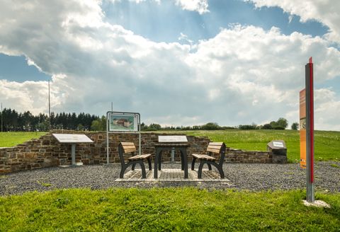
The view is worth it, especially when visibility is better than it was on this day. Across from the lounge chairs, benches and a table invite you to rest, and an information board explains what we’re seeing here.
The route continues along the Brinkenkopf—which rises nearly 600 meters above Köttelbach—toward Kelberg. Shortly before reaching the village, we enter the Kelberg Nature Experience Landscape. A detour to the Aremberg viewpoint lets us once again enjoy the Volcanic Eifel around Kelberg, where there are still a few volcanic cones that top 600 meters in height. We pass another juniper heath. These heaths are cultural landscapes where, apart from the juniper, the underbrush is kept short through grazing. A few goats can work wonders here! Following the Kelberger Bach, the route takes us past the sports facilities, the community center, and the recreational pool back to the starting point.
Further information
You can find more information about this tour in the tour planner.
Round trip
Touristinformation Kelberg
Dauner Straße 22
53539 Kelberg